
← All destinations
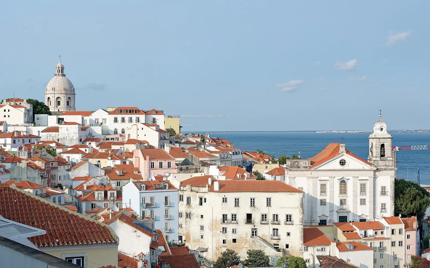
Alfama’s rooftops falling towards the Tagus, seen from Miradouro de Santa Luzia

Voyas · Lisbon, Portugal

Lisbon, told.

Eight places and two walks, each place with its story read aloud; the full guide to Lisbon is in the app.

See the two walks

No sign-up, nothing to install. Headphones help.

Photo: Jakub Hałun, CC BY 4.0

The places

Eight places, one story each

Each plays the overview and the first chapter, a few minutes, in the voice Voyas uses on the street, with music underneath and the sound of the place. Three threads run through them: the Tagus and the sea routes, the city rebuilt after the earthquake of 1755, and the hills.

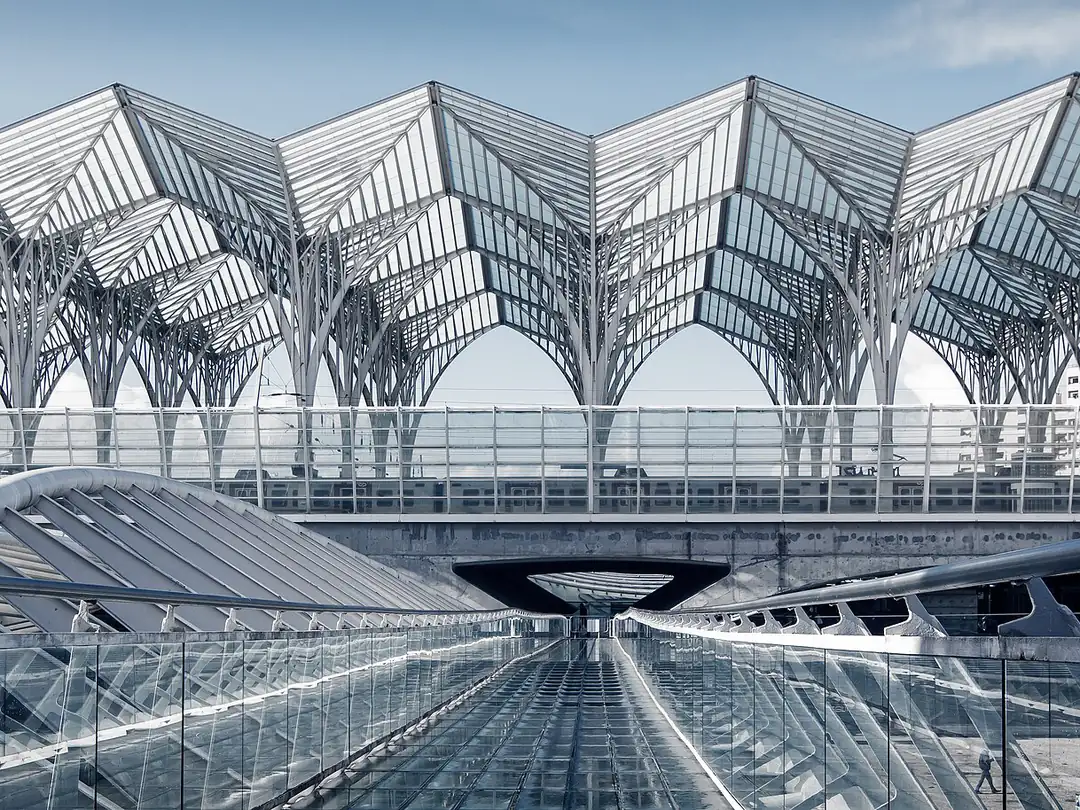
The white steel vaults of Oriente Station branching like trees above the platforms
Photo: Martin de Lusenet, CC BY 2.0

01Eastern waterfront, the Expo 98 siteEast of the centre

Parque das Nações

Before Expo 98, this shore held fuel depots, shipyards and docks.

The district’s arena, today the MEO Arena, was built for that exposition. Expo 98 turned a polluted industrial edge into a new district: Santiago Calatrava’s branching vaults crown Oriente Station, and Álvaro Siza Vieira’s Portugal Pavilion seems to hold up a sheet of concrete sky. Today it is a civil parish and a lived neighbourhood beside the Tagus.

0:002:54

See the place in Voyas

Transcript overview and chapter 1 of 4
  1. Parque das Nações
  2. Before the glass waterfront, Parque das Nações was a polluted working landscape of fuel depots and shipyards.
  3. Expo ninety-eight turned that neglected industrial edge into a new district.
  4. Santiago Calatrava's branching vaults crown Oriente Station, while Álvaro Siza Vieira's Portugal Pavilion seems to hold up a sheet of concrete sky.
  5. Today, Parque das Nações is both Lisbon's civil parish and a lived neighborhood beside the Tagus.
  6. Look up: what traces of the docks remain beneath this waterfront?
  7. From Industry to Expo
  8. Before Expo ninety-eight, this eastern stretch of Lisbon was a working industrial and port zone, not a waterfront quarter.
  9. For much of the twentieth century, Cabo Ruivo held warehouses, factories, fuel depots, shipyards and docks.
  10. Landfill and neglected spaces made the area polluted and uninviting.
  11. Even in nineteen ninety, this side of the city remained industrial.
  12. Then Lisbon won the right to host the nineteen ninety-eight World Exposition, themed The Oceans, a Heritage for the Future.
  13. The decision set a vast urban renewal in motion.
  14. Old industrial structures came down, and a new urban plan took their place.
  15. The change was not simply a fresh façade.
  16. It turned land managed for port activity into a new part of the city.
  17. Expo gave the area its turning point, but the transformation did not end when the visitors left.
  18. After the exposition, the site became a modern commercial and residential district, known as Parque das Nações.
  19. The name grew to cover the Expo grounds and the wider area managed for the project.
  20. Cultural and sporting institutions joined the new district, giving it a life beyond the event itself.
  21. Look to the architecture for the clearest sign of that ambition.
  22. Santiago Calatrava's Oriente Station is marked by sweeping vaults above its platforms.
  23. Nearby, Álvaro Siza Vieira designed Portugal's pavilion around a daring image, a sheet of paper resting on two bricks.
  24. Its vast pre-stressed concrete canopy makes that idea architectural, while the open entrance connects the building with the city.
  25. The eastern waterfront that visitors encounter now belongs to a quarter shaped by that break with industry.
  26. There, the Expo's public spaces and contemporary buildings carry the old port's outline into a different future.

Sources: Wikipedia (pt) · Wikipedia (en) · Wikidata · Wikipedia (en): MEO Arena
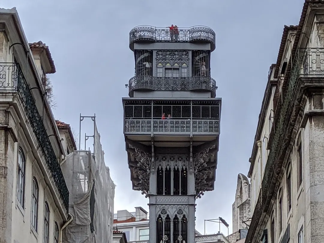
The cast-iron tower of the Santa Justa Lift rising between the buildings of the Baixa
Photo: Dicklyon, CC BY-SA 4.0

02BaixaWalk 1

Elevador de Santa Justa

In 1902 its safety gear was tested with a cabin left hanging above the city on its own.

Built under the engineer Raoul Mesnier du Ponsard, the lift joins the Baixa to Largo do Carmo. Its cast-iron tower wears lace-like Gothic decoration, and a metal walkway reaches across to the hill. Look up through the ironwork towards the ruined Carmo church.

0:003:07

See the place in Voyas

Transcript overview and chapter 1 of 5
  1. Elevador de Santa Justa
  2. In nineteen oh two, the Elevador de Santa Justa tested its safety gear with a cabin hanging above Lisbon on its own.
  3. That daring test helped prepare it for its opening later that year.
  4. Built under engineer Raoul Mesnier du Ponsard, the lift connects the Baixa to Largo do Carmo.
  5. Its cast-iron tower wears lace-like Gothic decoration, while a metal walkway stretches towards the hill.
  6. Look up through the ironwork towards the ruined Carmo church.
  7. A Lift for Lisbon's Hills
  8. In eighteen seventy-four, an engineer proposed a way to tackle the climb between the Baixa and Largo do Carmo.
  9. The engineer was Roberto Arménio, trained in both civil and military engineering.
  10. The problem was steep, and the solution was not yet obvious.
  11. Two years later, another proposal suggested animal-drawn rail cars running up an incline.
  12. Raoul Mesnier du Ponsard had a different idea.
  13. The engineer had begun his career with the Bom Jesus lift in Braga, which opened in eighteen eighty-two.
  14. By eighteen ninety-two, he had asked Lisbon's council for permission to build a metal tower near the Santa Justa steps.
  15. His proposed tower would occupy a rectangle about three metres wide and six metres long.
  16. His plan included a metal walkway passing above buildings to a garden at Largo do Carmo.
  17. It would carry passengers and their goods.
  18. The route from proposal to construction was hardly direct.
  19. In eighteen ninety-six, Mesnier sought a concession, but another applicant, Henry Lusseau, contested his request.
  20. Municipal public works officials supported Mesnier, and a provisional construction licence followed two years later.
  21. In eighteen ninety-nine, he joined surgeon João Silvestre de Almeida and the Marquess of Praia e Monforte in forming a company to secure a longer concession.
  22. The company sought the concession for ninety-nine years.
  23. A formal contract with the city came in nineteen hundred, requiring the company to present a project within six months.
  24. Work on the site's foundations was already under way by the middle of that year.
  25. Manuel Cardoso oversaw the workers building the lift.
  26. During construction, the viaduct and its supporting pillar were rotated into position.
  27. The lift opened in nineteen oh two.
  28. Steam powered the lift at first, until an electric motor replaced it in nineteen oh seven.
  29. Its metal tower and upper walkway gave Lisbon a new connection between the lower streets and the Carmo.
  30. The divide is still clear: below lies the Baixa, above it Largo do Carmo.

Sources: Wikipedia (pt) · Wikipedia (en) · visitlisboa.com · Wikidata · Wikivoyage

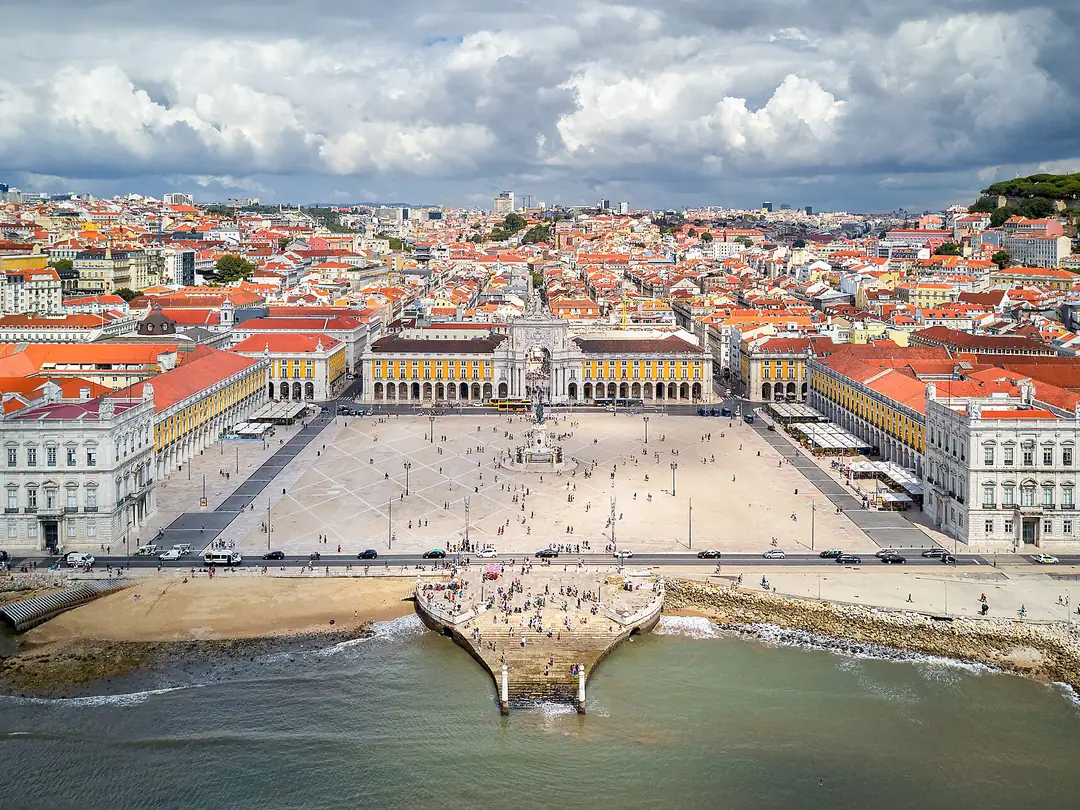
Aerial view of Praça do Comércio opening onto the Tagus, with the grid of the Baixa behind it
Photo: Deensel, CC BY 2.0

03Baixa, on the riverWalk 1

Praça do Comércio

A royal palace and its library of 70,000 volumes stood here until the earthquake of 1755.

The square was laid out in their place by Eugénio dos Santos, as part of the city’s rebuilding. Its arcades housed the offices that regulated customs and the port, while a bronze King José the First watched from horseback. Look towards the Tagus: the two towers recall the tower of the vanished palace.

0:003:00

See the place in Voyas

Transcript overview and chapter 1 of 5
  1. Praça do Comércio
  2. Lisbon's Praça do Comércio rose from the ruins of a royal palace and its seventy-thousand-volume library, lost in the earthquake of seventeen fifty-five.
  3. In their place, it became a grand riverside square, designed by Eugénio dos Santos as part of the city's reconstruction.
  4. Its buildings housed offices that regulated customs and port activity, while a bronze King José the First watched from horseback.
  5. Look towards the Tagus: the square's two towers recall the monumental tower of the vanished palace.
  6. The Palace Swallowed by the Sea
  7. Before the waves, a royal library held seventy thousand volumes beside the Tagus.
  8. In fifteen eleven, King Manuel the First moved his residence here from São Jorge Castle.
  9. His Ribeira Palace stood outside the city walls, close to a waterfront taking on a new role.
  10. Nearby grew a port, shipbuilding yards and the Casa da Índia, an institution overseeing overseas trade.
  11. The waterfront's administrators regulated commerce with Europe and Portuguese colonies across Africa, Asia and the Americas.
  12. Royal power and commerce shared the riverbank.
  13. On the first of November, seventeen fifty-five, the ground shook during the reign of King José the First.
  14. A tsunami followed, then fire.
  15. Together they destroyed much of Lisbon, including the palace and other buildings along the river.
  16. The palace library was lost too.
  17. The royal waterfront would never look the same.
  18. The king's chief minister, the Marquis of Pombal, coordinated the rebuilding, with architect Eugénio dos Santos leading the work.
  19. Santos designed a vast square open towards the Tagus.
  20. Buildings and ground-floor galleries formed a great U, with a tower at either end.
  21. The past remained visible in the new design.
  22. Yet the transformation took time.
  23. The eastern tower and the Rua Augusta Arch were not completed until the nineteenth century.
  24. The old name, Terreiro do Paço, means Palace Yard, a reminder of what once stood here.
  25. The new square became a centre of government rather than a royal residence.
  26. From the nineteenth century, its buildings housed important state departments, including the finance and maritime ministries.
  27. Even now, government offices occupy many upper floors, while cafés and restaurants fill spaces below.
  28. In the middle, King José the First sits on horseback, at the heart of a square shaped by disaster and reinvention.

Sources: Wikipedia (pt) · Wikipedia (en) · Wikivoyage · visitlisboa.com · Wikidata

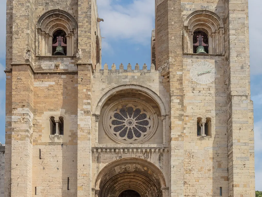
The twin towers and rose window of the west front of Lisbon Cathedral
Photo: Diego Delso, retouched by Kent Wang, CC BY-SA 4.0

04Below AlfamaWalk 1

Sé de Lisboa

Under its cloister lies a Roman road once lined with shops.

The cathedral rose on the site of the city’s main mosque after King Afonso Henriques and his allies took Lisbon in 1147. Its fortress-like battlements were added in twentieth-century restorations, long after the 1755 earthquake destroyed its Gothic main chapel. At the Romanesque doorway, look for a stranger sight: men fighting while mounted on lions.

0:002:56

See the place in Voyas

Transcript overview and chapter 1 of 6
  1. Sé de Lisboa
  2. Sé de Lisboa hides a Roman road once lined with shops beneath its cloister.
  3. It rose on the site of the city's main mosque after King Afonso Henriques and his allies took Lisbon in eleven forty-seven.
  4. The cathedral has survived earthquakes and reinvention.
  5. Its fortress-like battlements were added during twentieth century restorations, long after the seventeen fifty-five earthquake destroyed its Gothic main chapel.
  6. Look closely at the Romanesque doorway for a stranger sight.
  7. Men fighting while mounted on lions.
  8. A Cathedral After Conquest
  9. A mosque once stood on the site of Lisbon's cathedral.
  10. In eleven forty-seven, King Afonso Henriques and an army of Portuguese soldiers and northern European crusaders took the city.
  11. The crusaders were taking part in the Second Crusade.
  12. An English crusader, Gilbert of Hastings, became bishop, and a new cathedral rose on the site of Lisbon's main mosque.
  13. It marked a change in power, but not the beginning of Christianity here.
  14. Lisbon had been the seat of a bishop since the fourth century.
  15. Christians continued to live in and around the city during the centuries of Arab rule.
  16. After the conquest, work on the new cathedral continued into the early thirteenth century.
  17. Its first builders worked in the late Romanesque style.
  18. Around that time, the relics of Saint Vincent of Saragossa, Lisbon's patron saint, arrived from southern Portugal.
  19. Parts of that first cathedral survive on the west front.
  20. The main portal belongs to the early building, with Romanesque designs carved into the capitals above its columns.
  21. Inside, the nave still carries a barrel vault, a long, rounded stone ceiling.
  22. Above it runs an arched gallery.
  23. Narrow windows admit light through the side aisles.
  24. The rose window on the west front has an older ancestry too, though it was rebuilt from fragments in the twentieth century.
  25. Later generations changed the cathedral around its Romanesque core.
  26. King Dinis added a Gothic cloister, and his successor, King Afonso the Fourth, turned the main chapel into a royal burial place.
  27. The earthquake of seventeen fifty-five destroyed that chapel and its royal pantheon.
  28. Earthquake and fire also ruined the cloister and many chapels.
  29. The main chapel was rebuilt, and further renovation reshaped the cathedral in the early twentieth century.
  30. Through all that change, the old nave still holds its rounded vault.

Sources: Wikipedia (en) · Wikipedia (pt) · Wikidata · sedelisboa.pt

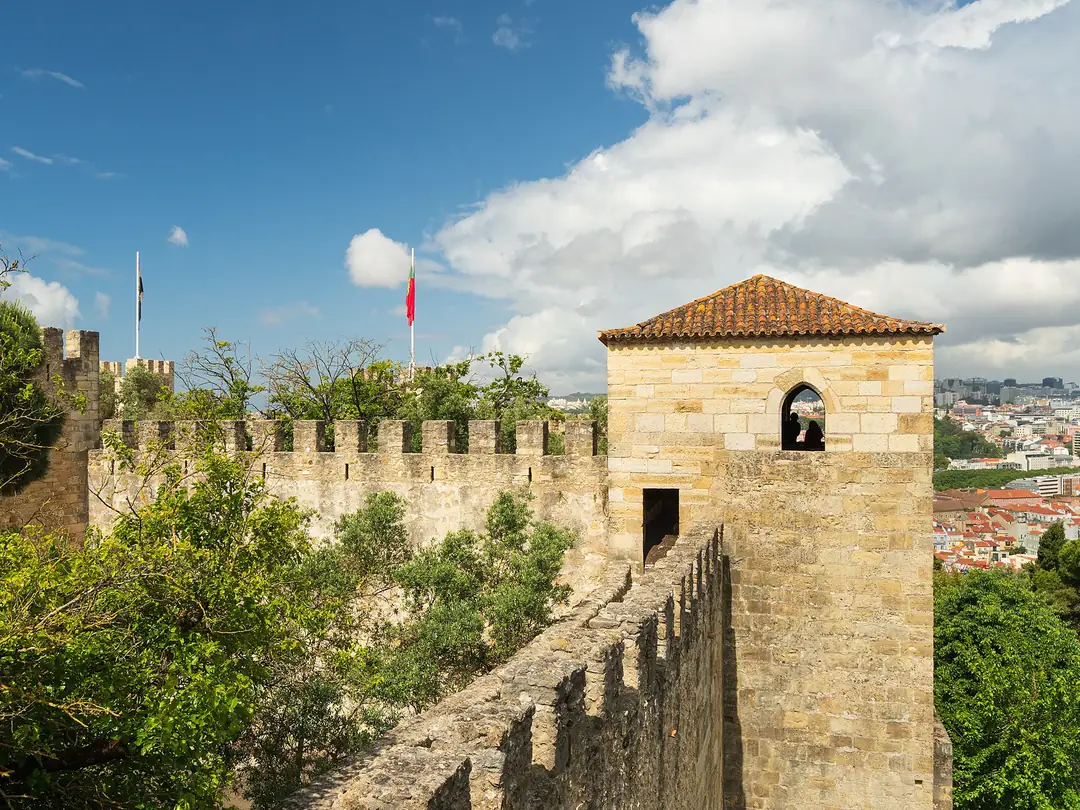
Battlements and a tiled-roof tower of São Jorge Castle, with the city spreading beyond
Photo: NorbertNagel, CC BY-SA 4.0

05São Jorge hill, above AlfamaWalk 1

Castelo de São Jorge

Much of the medieval look you see today was given to the castle in the 1940s.

Its story on the hill goes much further back. In 1147, Afonso Henriques and northern European crusaders took the Moorish stronghold after a siege. Later it became a royal residence, where King Manuel received Vasco da Gama after his return from India. Look for the surviving palace walls near the main square, with the city and the Tagus beyond.

0:003:09

See the place in Voyas

Transcript overview and chapter 1 of 6
  1. Castelo de São Jorge
  2. In the nineteen forties, Castelo de São Jorge acquired much of the medieval look visitors see today.
  3. But its hilltop story reaches much further back.
  4. In eleven forty-seven, Afonso Henriques and northern European crusaders captured the Moorish stronghold after a siege.
  5. Later, it became a royal residence, where King Manuel received Vasco da Gama after his return from India.
  6. Look for the surviving palace walls near the main square, with Lisbon and the Tagus beyond.
  7. The Hill Before the Castle
  8. People were living on this hill in the eighth century B C, long before the medieval castle took shape.
  9. From here, the ground commands the city and the Tagus estuary.
  10. The castle stands in Santa Maria Maior, on the highest hill in Lisbon's historic centre.
  11. It is now a national monument and museum.
  12. Over the centuries, successive communities made this hill their own.
  13. Celtic peoples, Phoenicians, Greeks and Carthaginians are all associated with the hill's early history.
  14. Romans came later, followed by Suebi, Visigoths and Moors.
  15. The earliest fortifications date to the last two centuries before the Common Era, long after people first occupied the hill.
  16. For some of these peoples, the hill served as a defensive outpost.
  17. The site changed hands again and again, and its fortifications were rebuilt by different communities.
  18. In the tenth century, under Moorish rule, fortifications included walls known as the Cerca Moura.
  19. The castle's archaeological exhibition brings that Moorish period closer, with objects from the eleventh and twelfth centuries.
  20. The Portuguese took Lisbon in eleven forty-seven, after a siege.
  21. Between eleven seventy-nine and eleven eighty-three, the castle withstood Muslim forces that had attacked the region between Lisbon and Santarém.
  22. The ruins of the former royal Palace of Alcáçova are still among the castle's sights.
  23. Later, the castle also housed military barracks and Portugal's national archive.
  24. In the early sixteenth century, the royal palace lost importance after Ribeira Palace was built beside the Tagus.
  25. An earthquake damaged the old castle in fifteen thirty-one, adding to its decline.
  26. By the first half of the twentieth century, the military complex had fallen into serious ruin.
  27. Reconstruction in the nineteen forties raised many towers and rebuilt much of the walls.
  28. Their medieval appearance owes much to that campaign, not simply to survival from the Middle Ages.
  29. The palace lies in ruins, while the hill still looks out across the city and the Tagus.

Sources: Wikipedia (pt) · Wikipedia (en) · Wikivoyage · Wikidata

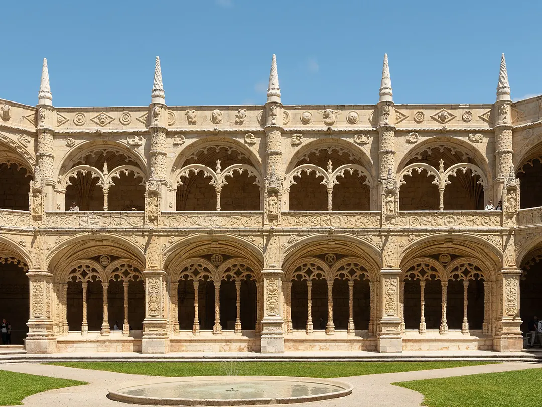
Two storeys of carved limestone arcades around the cloister of the Jerónimos Monastery
Photo: Norbert Nagel, CC BY-SA 4.0

06BelémWalk 2

Mosteiro dos Jerónimos

A levy on trade with Africa and the East gave it the equivalent of about 70 kg of gold a year.

It grew from the church where Vasco da Gama spent the night in prayer before his 1497 voyage to India. King Manuel the First replaced it with a monastery, and its carved limestone turned the wealth of maritime expansion into the style called Manueline. In the cloister, look for maritime motifs and royal emblems woven into the stone.

0:002:37

See the place in Voyas

Transcript overview and chapter 1 of 6
  1. Mosteiro dos Jerónimos
  2. Mosteiro dos Jerónimos grew from the church where Vasco da Gama spent the night praying before his fourteen ninety-seven voyage to India.
  3. King Manuel the First replaced it with a monastery funded in part by a tax on overseas trade.
  4. Its carved limestone turned the wealth of maritime expansion into an architectural language called Manueline.
  5. In the cloister, look for maritime motifs and royal emblems woven into the stone.
  6. A Monastery Paid in Pepper
  7. A levy on overseas commerce helped pay for this monastery, but pepper came with a twist.
  8. The tax on pepper, cinnamon and cloves went directly to the Crown, not to the building fund.
  9. The monastery rose beside a harbour where ships found shelter from the wind near the mouth of the Tagus.
  10. Before the monastery, a small church served the sailors who passed through Restelo.
  11. Monks of the Order of Christ offered them assistance there.
  12. By then, the old building was already in disrepair.
  13. King Manuel the First had a larger plan.
  14. In fourteen ninety-six, he asked the Holy See for permission to build a monastery on the site.
  15. Work began in the early fifteen hundreds and continued for about a century.
  16. The levy on trade with Africa and the East supplied an amount equivalent to roughly seventy kilograms of gold a year.
  17. Resources intended for Batalha Monastery were redirected to the new project in Belém.
  18. Manuel chose monks of the Order of Saint Jerome to occupy the monastery.
  19. They prayed for the king's soul and gave spiritual help to sailors setting out from Restelo.
  20. Among the architects was Diogo de Boitaca.
  21. The building became a major example of Manueline architecture, a Portuguese form of late Gothic design.
  22. The monastery also became a royal burial place.
  23. In eighteen eighty, Vasco da Gama and the poet Luís de Camões were moved into carved tombs in its church.
  24. Their tombs lie near those of kings Manuel and John the Third.
  25. Camões had celebrated da Gama's voyage in his epic poem, The Lusiad.
  26. Sailor and poet rest here together, close to the harbour where the voyage began.

Sources: Wikipedia (en) · Wikidata · Wikivoyage · Wikipedia (pt)

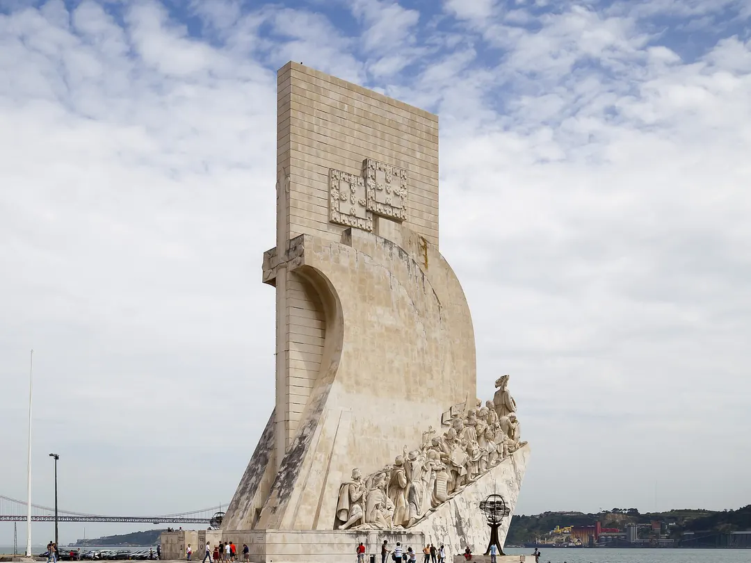
The Monument to the Discoveries, a tall stone prow with carved figures facing the river
Photo: Diego Delso, CC BY-SA 3.0

07Belém, on the riverWalk 2

Padrão dos Descobrimentos

Its first version, of iron, cement and plaster, was built in eight months for one summer: 1940.

It returned in concrete and stone in 1960. At its prow, Henry the Navigator leads explorers, artists and missionaries towards the Tagus. The monument presents a grand vision of Portuguese exploration, and exhibitions inside now invite debate about its colonial themes. On the plaza, a giant compass rose surrounds a map where a mermaid swims among the routes.

0:002:49

See the place in Voyas

Transcript overview and chapter 1 of 5
  1. Padrão dos Descobrimentos
  2. For the Portuguese World Exhibition, Padrão dos Descobrimentos first rose on Lisbon's riverbank as a ship designed to disappear.
  3. Created for the Portuguese World Exhibition in nineteen forty, it returned in concrete and stone in nineteen sixty.
  4. At its prow, Henry the Navigator leads a procession of explorers, artists and missionaries towards the Tagus.
  5. The monument presents a grand vision of Portuguese exploration, while exhibitions inside now invite debate about its colonial themes.
  6. On the plaza, a giant compass rose surrounds a map where a mermaid swims among the routes.
  7. Built for One Summer
  8. The monument before you was never meant to last.
  9. Its first version rose on the Tagus for the Portuguese World Exhibition, which opened in June nineteen forty.
  10. Architect José Ângelo Cottinelli Telmo and sculptor Leopoldo de Almeida had conceived it as a temporary beacon.
  11. They built it in just eight months.
  12. The exhibition stretched across Belém, from Praça Afonso de Albuquerque to the Belém Tower, with the Jerónimos Monastery as a backdrop.
  13. The monument itself had a light framework of iron and cement.
  14. Its sculptures were moulded from a mixture of plaster and fibre, supported by wood or iron.
  15. They looked substantial, but the materials were perishable.
  16. Telmo had first imagined a tribute to Prince Henry the Navigator.
  17. For the exhibition, the design grew to honour Henry's collaborators and followers as well.
  18. It presented a romantic vision of Portuguese exploration, characteristic of the Estado Novo regime led by António de Oliveira Salazar.
  19. Some admirers wanted the temporary monument made permanent, in marble or granite.
  20. Instead, after the exhibition, the original was dismantled.
  21. Two decades after the exhibition, the monument returned.
  22. Salazar chose to rebuild it for the five hundredth anniversary of Prince Henry's death, rather than pursue a different winning design for a memorial at Sagres.
  23. The replacement opened in nineteen sixty, made of concrete and stone.
  24. It now rises fifty-two metres above the riverbank.
  25. In nineteen eighty-five, a cultural centre opened inside, giving visitors access to exhibition space and the top of the monument.
  26. What began as a fleeting exhibition piece had become a place to look out over Belém.

Sources: Wikipedia (en) · Wikipedia (pt) · padraodosdescobrimentos.pt · Wikidata · Wikivoyage

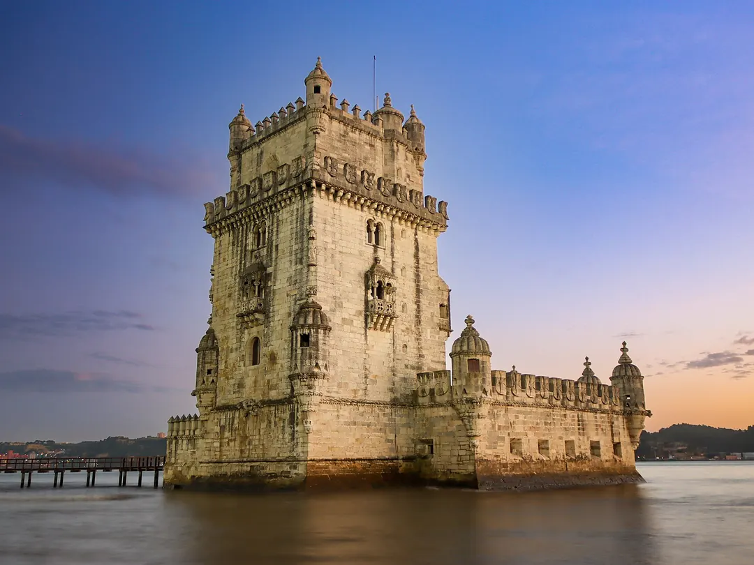
Belém Tower standing in the waters of the Tagus at dusk
Photo: Lisbon Photoshoots, CC BY-SA 4.0

08Belém, at the river mouthWalk 2

Torre de Belém

A stone rhinoceros on the tower recalls a live animal given to King Manuel by an Indian ruler.

The fortress was built between 1514 and 1520 to guard the mouth of the Tagus, and it also welcomed fleets returning from India. Francisco de Arruda designed it; its carved ropes and royal symbols speak of seafaring power, and its old ammunition stores later became prison cells. Look closely at the turrets for the rhinoceros.

0:002:23

See the place in Voyas

Transcript overview and chapter 1 of 5
  1. Torre de Belém
  2. Torre de Belém was built to guard Lisbon's river mouth, yet its stone rhinoceros points to a royal gift from India.
  3. It also welcomed fleets returning from India.
  4. Designed by Francisco de Arruda under King Manuel the First, the early sixteenth-century fortress combines military might with elaborate Manueline stonework.
  5. Its carved ropes and royal symbols speak of Portugal's seafaring power, while its former ammunition stores later became prison cells.
  6. Look closely at the turrets for the rhinoceros, a reminder of a live animal given to the king.
  7. A Fortress at the River Mouth
  8. The entrance to the Tagus had a gap in its defences.
  9. King João the Second intended to close it with a powerful new fort.
  10. Fortresses at Cascais and São Sebastião da Caparica already guarded the river, but they could not fully protect its mouth.
  11. The king died before his new fort could be built.
  12. His successor, Manuel the First, took up the plan.
  13. Construction began in fifteen fourteen and ended in fifteen twenty.
  14. The military architect Francisco de Arruda designed the stronghold.
  15. While it rose, a heavily armed ship called the Grande Nau guarded the estuary.
  16. Some building stone came from supplies gathered for the nearby Jerónimos Monastery.
  17. In fifteen sixteen, hundreds of blocks and stones arrived under the care of the project's treasurer, Diogo Rodrigues.
  18. The finished structure brought a tower and a bastion together in local limestone, known as lioz.
  19. The four-storey tower rises about thirty metres.
  20. Its design is a prominent example of the Portuguese Manueline style, with features also inspired by Moorish architecture.
  21. It was a fort, but it was meant to be seen.
  22. The tower welcomed fleets returning from India, celebrating their sea passage.
  23. A carved rhinoceros recalls an animal presented to Manuel by an Indian ruler.
  24. At the river mouth, defence and ceremony met in stone.

Sources: Wikipedia (en) · Wikipedia (pt) · patrimoniocultural.gov.pt · Wikidata

The walks

Two walks

The Baixa is about 8 km south-west of Parque das Nações in a straight line, and Belém about 6 km further west. The metro, trams and buses cover the distances; the old quarters are best on foot.

Walk 1About two hours

Baixa to the castle

From the iron lift down to the river square, then up through the old town to the castle walls, past the tiled terrace of Miradouro de Santa Luzia.

1Santa Justa Lift2Praça do Comércio3SéSanta Luzia4Castle500 mN
  1. 1Elevador de Santa Justastart
  2. 2Praça do Comércio0.7 km · 10 min
  3. 3Sé de Lisboa0.5 km · 7 min
  4. ·Miradouro de Santa Luzia on the way0.4 km · 7 min
  5. 4Castelo de São Jorge0.5 km · 8 min

About 2.1 km and 31 minutes on foot; about two hours with the stories and the visits.

Uphill from the Sé to the castle, on cobbles: shoes with grip help. The Sé is open Monday to Saturday, 10:00 to 18:00 from November to May.

See the walk in Voyas

Walk 2Half a day

Belém by the river

The monastery, the stone prow on the riverbank and the tower in the water: three monuments to the sea routes, a short walk apart, with time to go inside.

1Jerónimos2Padrão3Belém Tower500 mN
  1. 1Mosteiro dos Jerónimosstart
  2. 2Padrão dos Descobrimentos0.6 km · 9 min
  3. 3Torre de Belém1.2 km · 18 min

About 1.8 km and 27 minutes on foot; half a day with the stories and the visits.

Belém is west of the centre: take public transport there. The monastery’s cloister and the tower are closed on Mondays; Tuesday to Sunday they open 9:30 to 17:30.

See the walk in Voyas

Distances are straight lines between the stops, times 1.3 for the streets, at 4 km/h. The dashed lines are straight, not the streets.

Voyas tells the place you are standing in, with the sources behind every story. This page plays eight places; the full guide to Lisbon is in the app, and Voyas has city guides for Sintra, Cascais, Madrid and Marseille too.

City guidesRomania

Open Voyas All destinations

In the Voyas app

Voyas

Open Voyas

This page plays one story per place. The rest is in the app.